Destination B.C. and the Northern B.C. Tourism Association have partnered with Google to journey beyond the road this summer, to add stunning imagery from Northern B.C.'s wild places to Google maps.
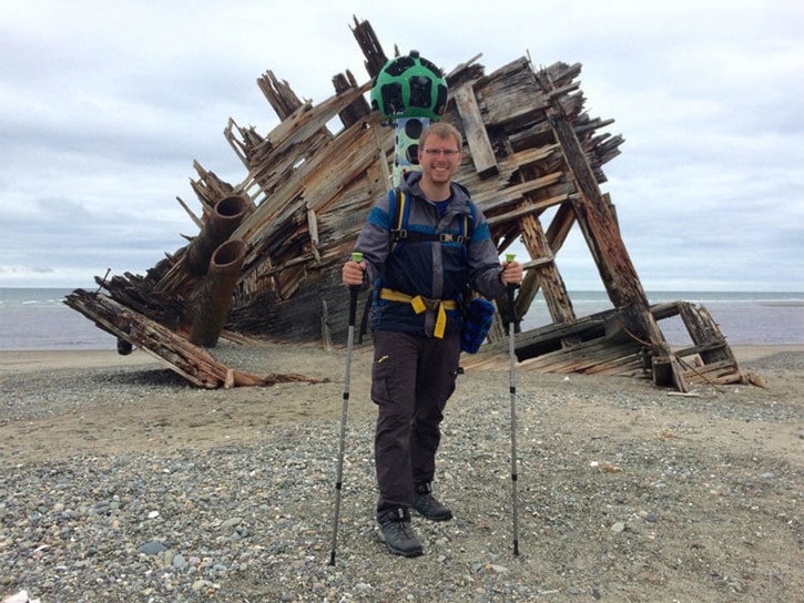
Using the Google trekker - wearable backpacks outfitted with 15 separate cameras that collect 360-degree panoramic imagery -, team members trained by Google will spend the next few weeks exploring remote outdoor locations in B.C.
Until September, the team will hike desert trails, roam old-growth forests and climb majestic mountains to capture iconic destinations rich in culture and history.
“Bringing the trekker to British Columbia is part of Google’s goal to create the world’s most comprehensive, accurate and usable map," explained Nicole Bell, a spokesperson with Google Canada. "More than one billion people around the world use Google Maps every month, and the images collected over the next few weeks will help to put some of British Columbia's iconic landscapes on the proverbial map of tomorrow."
It is still unclear, however, if the Google trekker will be capturing destinations in the Lakes District area.
According to Tasha Peterson, content and social media specialist for the Northern B.C. Tourism Association, not all areas where that the trekker will visit have been determined yet.
"It is definitely a possibility to come to Burns Lake," said Peterson. "We are looking to cover as much as possible, but I can't say specifically if we're coming to Burns Lake or when that would be."
Google and its provincial partners are not discussing specifically when or where the trekker will be so that the imagery is not compromised, according to Peterson.
"If people want to see the trekker, they might try to meet someone in some area, and in order to get the best imagery we can't have people in that capture," she explained.
"Once we've been somewhere, we're able to put that information up [on their website] and talk about that experience," she added.
The public can follow where the Google trekker has been at www.treknorthernbc.com. If people are captured on the imagery, their faces will be blurred by Google.
After the images are collected, they will be sent to the Google Maps team in California to be processed and uploaded to Google Maps, which takes several months.
People from around the globe will then be able to virtually hike in some of the province’s vast wilderness.
When the images go live on Google Maps, Northern B.C.'s wild places will join a select group of bucket-list street view trekker destinations such as the Pyramids of Giza, the Grand Canyon and the Galapagos Islands.
This is the largest trekker mapping project ever undertaken between a provincial tourism marketing organization and Google in Canada.
In about 100 days, teams will trek more than 1500 kilometres throughout B.C. to visually map a collection of must-see destinations in every region of the province.