Geoscience B.C. has chosen Burns Lake's Baker Airport as the base for its largest airborne magnetic survey to date.
The survey will produce new data used to identify hidden mineral potential and guide land-use decisions in the region.
"When we finalized the contract and boundary for the survey, Burns Lake was perfectly centred and an obvious choice for the survey base," said Bruce Madu, Geoscience B.C.'s vice president of minerals and mining. "Geoscience B.C. is very excited to be working from Burns Lake on this large survey."
The survey started about two weeks ago and is expected to take approximately two to three months. The length of the survey will depend on weather and aircraft availability.
According to Madu, approximately 40-45 per cent of the project budget will go directly into the region's economy. This would include fuel purchases, maintenance of the aircraft and the crews of 10 or more that will be staying in town and eating at local restaurants.
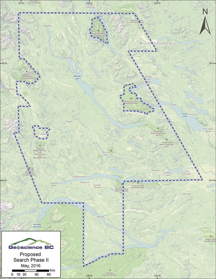
The survey will cover a 24,000 square kilometre grid that extends north to Pathway Lake and south to Ootsa Lake, and east-west from Fort Fraser to Smithers - an area equivalent to 75 per cent the size of Vancouver Island.
The project will occur over the traditional territories of the Carrier Sekani and Wet'suwet'en First Nations. Madu said Geoscience B.C. has been engaging with First Nations communities since last February.
"We are continuing our engagement with area First Nations and communicating about the program," he said. "The intensity of engagement does increase as the project draws near and we have specifics to share."
Geoscience B.C. had not selected a contractor for this survey until late June and the company only recently decided that Burns Lake would be the base of its operations.
"We wanted to wait until the contractor was confirmed before we initiated wider-scale community engagement," he explained.
Madu expects to be in Burns Lake next week to engage with the community.
"We're planning on inviting area First Nations, local government and members of the media for a tour of the aircraft and to learn more about the data collection later this month as part of our community outreach program."
A total of three aircrafts will be used to conduct this aerial survey. The aircrafts are equipped with a sensitive magnetometer that detects and records local disturbances in the earth's magnetic field, which are caused by magnetic minerals in the upper regions of the earth's crust. These magnetic signatures are then represented plotted on multi-hued maps for explorers to analyze and focus their on-the-ground exploration activities.
"What I like about the work done in our backyard by Geoscience B.C. is that these detailed results are available to everyone," said Smithers Exploration Group president Rob Maurer. "Usually only the largest companies have access to this kind of data. But in B.C., the innovative work conducted by Geoscience B.C. puts tools in the hands of any individual who wants to go out and prospect for minerals."
Geoscience B.C. is an independent, non-profit organization that generates earth science information. Last month, the organization received $5 million in funding from the B.C. government.
"When I ask exploration companies and prospectors what distinguishes B.C. as an attractive place to invest, the answer I get back most often is the quality and availability of geoscience information," said Bill Bennett, Minister of Energy and Mines and Minister Responsible for Core Review. "Our decision to form Geoscience B.C. more than a decade ago is paying huge dividends to all British Columbians in the form of new mining projects and hundreds of new jobs."
Sander Geophysics Limited was the contractor chosen by Geoscience B.C. to conduct the survey.
Results from the survey will be publicly available in 2017 at www.geosciencebc.com/s/datareleases.asp