Contributed by Doug Van Tine
The water in Ootsa River was some of the purest in the entire chain of lakes and rivers. We were told that it was 98 per cent pure at that time.
The river was nearly five miles long with two sets of rapids. The fishing was excellent. I have held a fly on a rod above the surface, and the fish would actually jump out of the water for it.
Intahta Lake was about eight miles long, with a lot of meadows on the south side. The north side was low bank, with several wonderful beaches. In fact, one beach was called Lady Susan Point, and that is where Lord and Lady Tweedsmuir camped when they named Tweedsmuir Park.
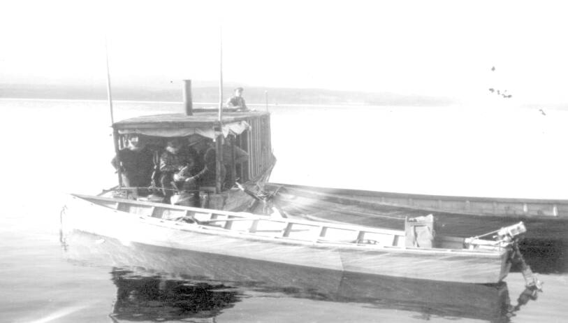
It was a large camp and employed all local people. My Dad and two of my brothers Meryl and Buster guided there, and one of my sisters Margaret worked in the kitchen. There were a lot of other locals hired with pack horses and even an aircraft, owned by Russ Baker from Ft. St. James.
Intata River was about two miles long, with a gravel bottom. There was a large eddy about halfway down; no rapids, but fast water and good fishing.
Natalkuz Lake was like a horseshoe, beautiful clear water and about eight miles east to the mouth of the Nechako River, and then turning west for another eight miles. Nechako River had some fish camps of local guides. I had about 20 miles of navigable waters with superb fishing and hunting. Then came the gorge, which was not navigable, and later years was the site of what is now the Kenny Dam.
Near the head of the Natalkuz was the Chelaslie River, only half a mile of slow running river, which opened into Chelaslie Lake in a westerly direction for about 10 miles. Very good hunting, and also a winter-feeding ground for moose and caribou.
Further to the west of Natalkuz was the Uchu River which was about a mile long, and then Uchu Lake. A very pretty lake with mountains in the south and fairly flat land in the north. It did not have many beaches so was mostly rocky shores. It was about six miles to the foot of the Tetachuk River.
The river was nothing short of beautiful. It was fast water for the first few miles, to the foot of the first set of waterfalls. This spot was probably the best fishing that I have ever seen. In fact, my brother Jim and I had a fish camp there for a few years before the flood occurred.
Above this, about a quarter mile, was a second falls. There had been a trading post here, operated by Fred Aslin, in the early days. The Bella Coola trail also crossed the river here, and is the path of the earliest pioneers that settled at Ootsa Lake in the early 1900s. The river continued west before entering Tetachuk Lake, a few miles upstream.
Tetachuk was about 20 miles long and a beautiful lake. Brian Arm was on the south side and later became a favourite spot for a lot of vacationers. Tetachuk was not often used in the early days, because of the waterfalls on Tetachuk River and Redfern Rapids on the Eutsuk River, so remained difficult to access.
At the west end of Tetachuk Lake is the Eutsuk River; about four miles long with a set of rapids in the middle called Redfern. The early pioneers avoided these rapids most of the time because of fast, shallow water, and under powered outboards. There was a big, flat rock in the fast water, causing a large wake on the lower side, guaranteed to get you wet.
Dad chuckled at this and told me that he got wet every time, but had never overturned a boat in his life.