Water levels in the Lakes District are still increasing.
Village of Burns Lake fire chief Jim McBride gave council an update on the local flooding situation, saying that he expects water levels to continue to increase over the coming weeks.
"Burns Lake is at an apex water wise where most of the water travels to the east and west, so the water impact on the Village of Burns Lake is minimal," McBride said.
He said however that there was some anxious moments last week when water levels in Saul Creek rose quickly.
"I am keeping my fingers crossed, but at the moment the village's culverts are free flowing," he added.
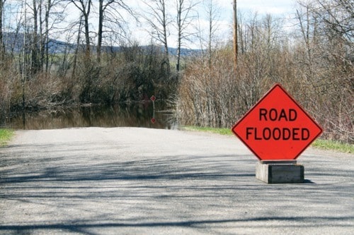
Properties along Pioneer Way have been impacted by rising water and sand bags are place. Water has also impacted Gerow Island.
McBride said the village has an emergency operations centre currently up and running. "We are at level one which means we are working to keep people informed," he said.
"This same time last year I was dealing with 23 grass fires, this year we have had just two," he said.
Other communities in the Regional District of Bulkley Nechako (RDBN) remain on high alert.
The Bulkley River in Houston is rising and the area around Buck Flats is being pumped and diked in an effort to manage the volume of water.
Given the current snow pack accumulation, the delay in the onset of spring melt into May and the current weather forecast for continuing rain, the RDBN is advising residents of the potential for flooding in low lying areas adjacent to the Bulkley River.
The Ministry of Forests, Lands and Natural Resource Operations has also issued a flood watch warning for the Bulkley River.
Dave Campbell from the River Forecast Centre said that over the past 10 days there has been an onset of snow melt at low to mid level elevations in the local area.
"There is still a significant level of snow left, so it will be an ongoing melt. For several weeks there will be elevated flows into local rivers, streams and lakes," he said.
Evacuation alerts have been issued by the RDBN for the North Bulkley Post Office Road and Houston rural area, near Hwy. 16.
An evacuation alert has also been issued for the 28 kilometre mark of Grizzly Forest Service Road, including the areas of Pinkut Creek spawning channels and Taltapin Lake. The Pendleton Bay area was under an evacuation alert, however this was rescinded late last week. All local roads are now reopened.
Campbell said Francois Lake levels increased steadily over the last week.
He said that water levels in lakes tend to have a delayed response and increase at a much slower level that rivers.
Francois Lake will continue to show an increase, with steady inflows of water and if the rainfall continues it will push lake levels even higher. Babine Lake is also high and water levels increased with last week's rainfall.
Decker Lake has reached a plateau, with the snow melt in this area at a lower elevation. "The response is muted in Decker Lake as there is less inflow coming in," Campbell said.
While Campbell said water levels in Burns Lake are not gauged he is aware that the lake is showing increased levels of water.
"Ootsa Lake is part of the reservoir system and levels are controlled by Rio Tinto Alcan so the levels of Ootsa Lake are fine, it is a big lake system," he said.
The Water Office of Canada show an increase in the raw water level of the Nechako Reservoir at the Skins Spillway of half a metre since May 20.
On May 24 the primary raw water level peaked at 4.26 metres at Cheslatta Lake at West End. The water level has now levelled off to 4.22 metres.
"This is not unusual, but it is a rare snow pack .... it's something that happens every 10 to 15 years," Campbell added.
Local resident Daryl Critchlow regularly monitors the level of Francois Lake from his home. He has keep a recording of lake levels for a number of years and said to Lakes District News that according to his measurements the water level is increasing.
"Last week it was increasing by five centimetres per day, this week it is 2.5 centimeters per day until Thursday when the water level increased by 8.255 centimetres overnight," he said.
"We are currently 30 centimetres above the high water mark from two to three years ago," Critchlow added.
He also said Francois Lake is still 66.25 centimetres below the peak level from 2007.
"The typical high water level is June 10 so we are still a couple of weeks away from that." However, given the continued increase in water levels, Critchlow said he feels that flooding is imminent and plans to put sandbags down to protect his property.
He takes his readings from an inland marina where the water remains calm and he said he is able to get a good reading from this location.
Jason Llewellyn RDBN's director of planning said the water level for Francois Lake is also officially monitored by a Ministry of Environment gauge located at the Francois Lake ferry landing. He agreed that the water level is higher than normal for this time of year and he anticipates that levels will increase over the coming weeks.
According to Llewellyn, Francois Lake is the only lake in the local area that is officially monitored by a gauge.
Future weather conditions including precipitation and speed of snow melt will figure strongly into the rate the water rises and the overall levels reached.
For up to date information on the status of local rivers go to the B.C. river forecast centre at www.bcrfc.env.gov.bc.ca/warnings. For information on current RDBN evacuation orders and alerts go to www.rdbn.bc.ca.