Newly published research by a University of Northern B.C. senior laboratory instructor has shed some light on to spots along Northern B.C.’s highways that are considered hotspots for moose-vehicle collisions.
Roy Rea, Senior Laboratory instructor at UNBC used data from the Wildlife Accident Reporting system between the years of 2000-2005 to identify 29 moose-vehicle hotspots along Northern B.C.’s highways.
The study area was located in Northern B.C. from the South in Quesnel to the North in Wonowon, and from the West in Prince Rupert, to the Alberta border in the East.
The highways that Rea studied included, Hwy. 16 from Prince Rupert to the Alberta border, Hwy. 27 from Vanderhoof to Fort St. James, Hwy. 35 from Burns Lake to Francois Lake and Hwy. 118 from Topley to Granisle.
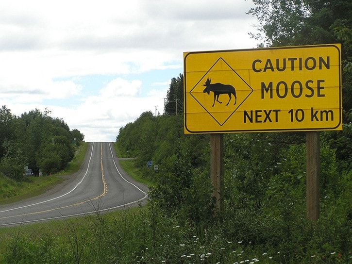
After identifying the hotspots, Rea examined the characteristics of each hotspot in order so that new hotspots in the future would be easily identifiable and marked with warning signs for driver safety.
“A sign may have gone up 30-years-ago where there used to be a hotspot, but now the mountain pine beetle has gone through and wiped out all the trees, it’s farmland now and not a collision hotspot anymore,” Rea said, “signs need to be timely, current and reflect the actual collision data.”
That is where the Ministry of Transportation has stepped in.
The hotspots that Rea was able to map out from his findings have changed, which according to him is a good thing because it means the Ministry of Transportation is updating their analysis every five years.
According to Ministry of Transportation data from 2004-2013, four of the top five moose-vehicle collision hotspots are located between Burns Lake and Vanderhoof.
The fifth hotspot is located between Burns Lake and Houston.
The top hotspot is located between Hassel Rd. and McNolty Rd. on Hwy. 16 between Burns Lake and Vanderhoof, and averages 1.5 moose-vehicle collisions annually.
A sixth hotspot that drivers in Burns Lake need to be aware of, is along Hwy. 35, heading out to the Francois Lake ferry terminal.
Again, Ministry of Transportation data from 2004-2013 shows, that between Frame Rd. and Hill Rd. on Hwy. 35, there is an annual average of 1.1 moose-vehicle collisions.
Rea looked at a number of factors in order to identify collision hotspots.
He looked at fine-scale environment factors, which include the number of salt licks and verge vegetation height, coarse-scale environment factors, including the total area of lakes within each buffer and the presence of rivers on either side of the highway and road infrastructure factors, which include wildlife warning signs and ditch depth.
In the end, Rea determined that there were four factors that were more significant than the others when determining hotspots for these collisions.
“Where there are black spruce bogs and swamps, roadside mineral licks, where the road cuts through mixed forest cover, for example deciduous and coniferous and where there is important roadside browse like willow, aspen, birch and dogwood,” Rea said, of the four significant factors.
Mineral licks are formed when road salt, left roadside, either from runoff or road salting in the winter months, accumulates in roadside ditches.
Moose use these licks, which leads to accidents.
There’s a season for these types of wildlife accidents.
Typically, there is a big peak for moose-vehicle collisions in January and a smaller one in July, after roadside mineral licks have formed, and moose venture out to use them.
While environment and infrastructure characteristics helped Rea identify collision hotspots, he said that they are in no way the only factors involved in these collisions, noting that driver behaviour plays a significant role in these accidents.
“Oh yes, driver behaviour is a big factor. We just couldn’t measure it with this study,” Rea said.