Recent flooding on the roads of the Lakes District — and notably the destruction of a stretch of Ootsa Nadina Road by floodwater — brings up some questions of accountability.
As the deluge approached, the head of the River Forecast Centre, David Campbell, held a teleconference for reporters. Journalists from across the province all wanted to know if their community would be hit by flooding.
When asked about the potential for flooding around Burns Lake and Houston, he said the major rivers in the area weren’t currently a major source of concern. But he said that some of the smaller tributaries could overflow.
And the best source of information about local streams and creeks, according to the head of the River Forecast Centre, would be the regional district.
And yet, when the Lakes District News contacted the Regional District of Bulkley-Nechako (RDBN), the planning department there issued a statement encouraging people to monitor the website of the River Forecast Centre, along with the RDBN’s website and emergency information Facebook page. Those RDBN organs issued very little information when flooding occurred.
Just like the cycles of water, the buck had been passed full circle.
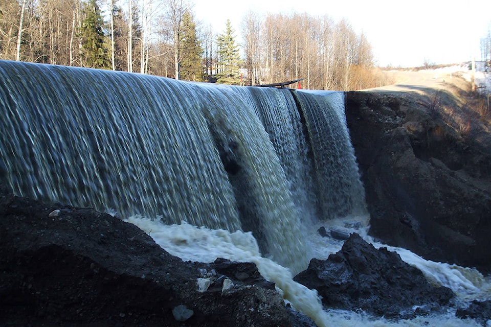
Flooding has taken place in numerous locations in the region —most notably near Ootsa Lake, where the meltwater spectacularly destroyed an entire section of Ootsa Nadina Road.
Perhaps the organization most well-suited for providing up-to-date information about conditions on the roads would be Lakes District Maintenance (LDM), the company that holds the highway-services contract for the region.
Their signature orange-yellow trucks are a constant presence on the road, which suggests an ability to observe developments across the region.
To their credit, LDM has been sharing updates about the flooding conditions with the general public through channels including its Facebook page and through local radio.
And although communication isn’t the traditional role of a highway maintenance firm, we have reason to want a clearer picture of up-to-date information about flooding.
It’s worth remembering that the highway maintenance company is funded by tax dollars from the provincial government. In effect, it’s providing a public service, which implies a high level of responsibility to residents.
And mapping technology is surely available that could allow for mobile updates about road conditions and flooding.
As climate change produces more and more extreme weather, all levels of government should be considering how they will communicate with residents about floods and other natural disasters.
Perhaps the main thing to keep in mind if an emergency hits is the importance of community.
Even if government authorities aren’t providing up-to-date information, ordinary people can reach out to each other through social media, phone trees or just by knocking on doors.
It’s worth considering, because the wash-out at Ootsa Nadina Road might just be a dress rehearsal for whatever comes next.