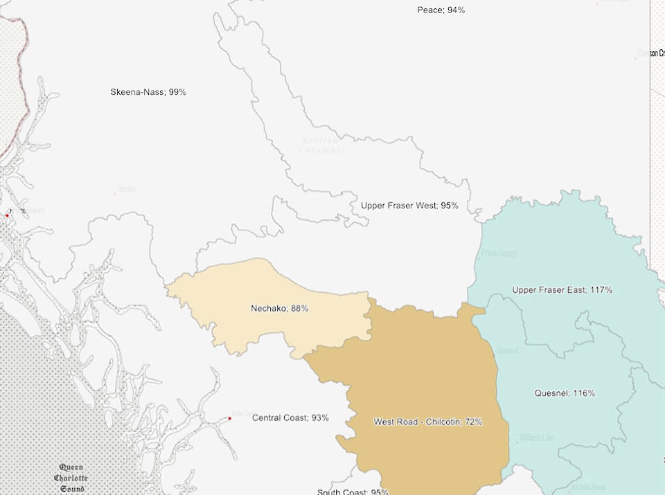
According to the B.C. government website, April 1 statistics indicate that snowpack numbers in the Burns Lake area are decreasing since March 1, when it was last calculated.
The snowpack indices are calculated by percentage of the normal seasonal peak of the year.
For Nechako, the snowpack measured at 88 per cent of normal compared to 95 per cent on March 1, Skeena-Nass measured at 99 per cent of normal compared to March 1, and Upper Fraser West measured at 95 per cent compared to 103 on March 1.
At this point, the Burns Lake area is not at a high risk of flooding. All three regions are fairly close to 100 per cent of normal, and according to the website only regions with an above normal snowpack have a higher risk of flooding.
The weather conditions during spring play a critical role in the rate at which the snow melts. For example, a gradual warming under dry conditions is ideal to lessen the flood risk. A lengthy cold period with high amounts of precipitation followed by a sudden extreme heat wave could lead to flooding.
READ MORE: Fraser River basin snowpack numbers for Burns Lake area
“The combination of near normal April 1 snow pack, La Niña conditions forecast to persist through spring, recent snow accumulation during the first week of April, and seasonal weather forecasts that predict cooler conditions for the province means a slightly elevated risk for freshet-related flooding (across the province),” the government document states.
For the province as a whole, snowpack indices range from a low of 74 per cent of normal on Vancouver Island and the Okanagan to a high of 134 per cent in the Northwest.
The next expected snowpack report for May 1 is expected to come out on May 10.
Have a story tip? Email:
Eddie Huband
Multimedia Reporter
eddie.huband@ldnews.net
Like us on Facebook and follow us on Twitter.
