Authorities are advising residents to be prepared for flooding in the Lakes District and across the B.C. Interior, as rapidly increasing temperatures lead to accelerated snowmelt.
Officials from local government and industry are keeping a close eye on developments as forecasts call for temperatures reaching 21 C on Thursday and Friday in Burns Lake and Houston.
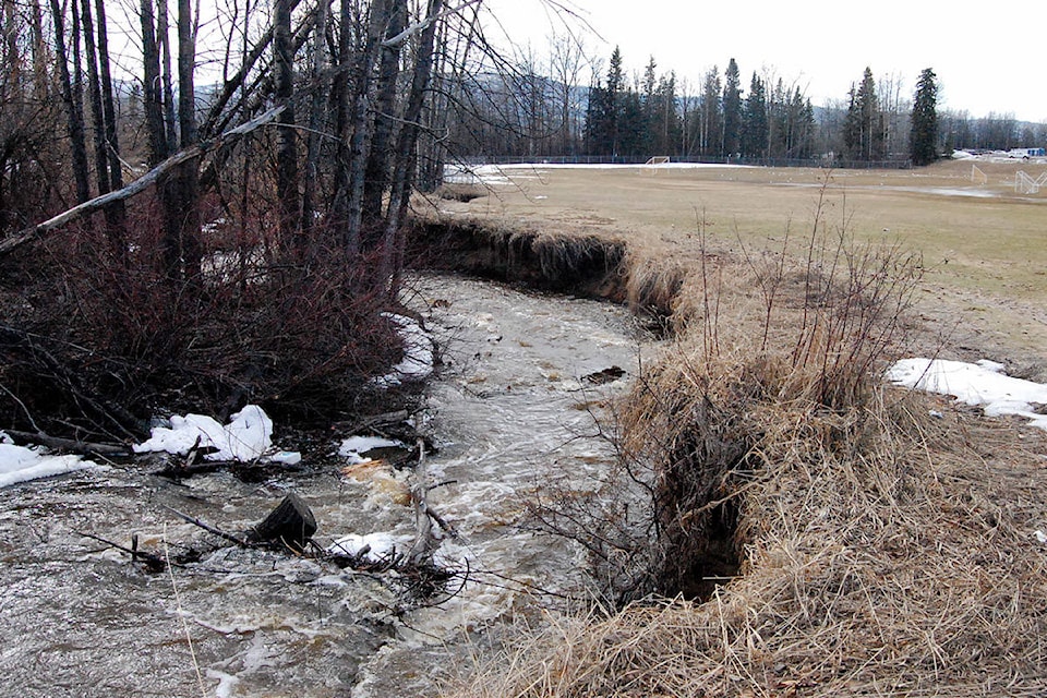
Sandbags ready
The Regional District of Bulkley-Nechako (RDBN) said that district staff are monitoring the situation and ready in case of a deluge, although no warning or advisory is currently in effect for the area.
“The RDBN is monitoring local water courses and lakes, with the assistance of the BC River Forecast Centre, and we are prepared to respond as appropriate,” said Jason Llewellyn, director of planning for the RDBN, in an email to the Lakes District News.
READ MORE: Hot weather leads to overflows at Saul Creek
“The RDBN have sandbags available in a number of locations across the region which can be distributed to residents along with sand in the event of an imminent risk of flooding to a dwelling,” he said.
The abrupt change in weather is a source of concern for the lumber industry, as flooding could lead to instability on logging roads and bridges.
Hampton Lumber CEO Steve Zika said the company is keeping an eye on areas of concern.
“We have an inventory of our areas that we are concerned about and we are monitoring these areas on a daily basis to ensure we don’t end up with road failures or washouts,” said Zika in an email.
“In the event that we start seeing things that we are concerned about, we have maintenance crews that are ready to go out and remain in areas as needed.”
Rapid melt
Changes in temperature may trigger heavy melting in the Lakes District, said David Campbell, head of the provincial River Forecast Centre.
Campbell said the Bulkley River isn’t currently a source of concern, but that smaller tributaries could rise with the sudden onset of the spring freshet. “We definitely are seeing localized pockets of quite high snowpack,” said Campbell.
“We haven’t really seen melt yet there significantly,” he said during an April 23 media briefing. “I think this will notch those areas up a bit.”
He noted that Buck Creek — which passes under Highway 16 in Houston — is one waterway that may see flooding.
By the beginning of April, the snow-water equivalent — a common measure of snowpack levels — stood at 204 mm in Burns Lake, compared to an average of 119 mm between 1981 and 2010. That means the snowpack was 171 per cent the historical norm.
Environment Canada is forecasting that temperatures in Burns Lake will reach 21 C on Thursday and again on Friday. Highs are expected to drop to 14 C over the weekend and then spike to 20 C again next week.
The latest high streamflow advisory from B.C.’s River Forecast Centre, issued on April 25, doesn’t single out the Lakes District but indicates that accelerated snowmelt could occur in the South Interior, Boundary, Kootenay and Central Interior regions.
Be prepared
Asked how ordinary people should prepare for potential flooding, Campbell referred the Lakes District News to the website emergencyinfobc.gov.bc.ca.
He added that people should exercise special caution around rivers and streams, noting that riverbanks are very unstable.
The RDBN also reminded residents to exercise special care around bodies of water, and to be prepared with an emergency kit.